Mapping the Ocean: Physical Cartography
-
English
-
ListenPause
[intro music] Welcome to World Ocean Radio… I’m Peter Neill, Director of the World Ocean Observatory. A far too familiar phrase in the world ocean conversation has been: “We know more about the surface of Mars than we do about the ocean.” As with all such repetitions, they are based on an irrefutable truth of the fact that we have explored and documented to every corner of the land and have only rudimentarily done so with the other 71% of the earth: the still mysterious ocean. As we now realize our need for that ocean for so many aspects of our future survival – freshwater, food, energy, health, and much, much more – we have finally begun to expand our understanding of ocean value in all its dimensions. Cartography is defined as “the art and science of graphically representing a geographical area, usually on a flat surface such as a map or chart. It may involve the superimposition of political, cultural, or other nongeographical divisions onto the representation of a geographical area.” How that has changed from the hand-drawn incomplete surveys and maps of our era of exploration during which the full extent of the ocean, a three-dimensional space, was discovered and reduced to two, with so much left out, especially below the surface. The areas described were mostly regional and often left void, and super-imposition of non-geographical, and political and cultural divisions absent. That situation has changed dramatically. Today, oceanography, marine biology, and numerous other disciplines, such as chemistry, physics, climate science, satellite mapping, and many others, are being brought to bear with intensity and new technology for accuracy, visualization, data collection and management, as well as multiple layers of documentation and analysis. For example, Japan’s Nippon Foundation has recently announced Seabed 2030, a joint project of the International Hydrographic Organization, UNESCO, and the UN Intergovernmental Oceanographic Commission to assemble—as part of United Nations Decade of Ocean Science for Sustainable Development—a publicly available, definitive, high resolution 3D bathymetric map of the entire world ocean through a massive, coordinated initiative among universities, research and government organizations for the scrutiny of observation and the collection of data that will result in enormous amounts of new information, new representations of the knowledge derived, and new understandings and opportunities for human interaction with the world ocean as a known space measured and revealed. It is, then, a time of remarkable discovery on the ocean floor. For example, the Schmidt Ocean Institute, a private philanthropic research ocean organization founded “to advance oceanographic research through the development of innovative technologies, open sharing of information and broad communication about ocean health,” operates a state-of-the art research vessel, R/V Falkor, that serves as a platform for scientists to enable the advanced technology to access the ocean floor, to observe and record, to take samples for sophisticated analysis, and to contribute to Seabed 2030 specifically by its ongoing, 12-month research cruise in Australian waters. On October 20, 2020, using the Falkor underwater robot, SuBastian, scientists discovered near the Great Barrier Reef, a World Heritage site, a massive detached coral reef more than 1600 feet tall, higher than the Empire State Building in New York, heretofore unknown, the dive live-streamed with high-resolution footage, available in real time to the public. The reef base is almost 5000 feet-wide, then rises to its shallowest depth only 130 feet below the sea surface. The discovery of this new coral reef adds to a year of underwater discoveries by Schmidt Ocean Institute. According to its website, “In April, scientists discovered the longest recorded sea creature – a 45 meter siphonophore in Ningaloo Canyon, plus up to 30 new species. In August, scientists discovered five undescribed species of black coral and sponges and recorded Australia’s first observation of rare scorpionfish in the Coral Sea and Great Barrier Reef Marine Park. And the year started with the discovery in February of deep sea coral gardens and graveyards in Bremer Canyon Marine Park.” Think about this. A giant underwater structure never known. Gardens and graveyards. More that 40 new species that we never knew existed until now. All these discoveries have been visualized and mapped. The footage must be seen to reveal the extraordinary beauty of these places, life forms as art forms in a place just offshore where humans have not yet tread. What cultural or political divisions will we superimpose? Cartography is more than just markings on a paper. It is knowledge. What will we do with what we know? We will discuss these issues, and more, in future editions of World Ocean Radio. [outro music]
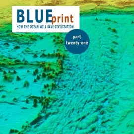
This week on World Ocean Radio: part twenty-one of the multi-part BLUEprint series. In this episode we introduce listeners to the concept of ocean mapping and the GEBCO Seabed 2030 project which promises to develop a high res 3d bathymetric map of the entire world ocean. And we share some new and exciting oceanographic research discoveries made by the Schmidt Ocean Institute in the waters off Australia.

The "BLUEprint Series: How the Ocean Will Save Civilization" outlines a new and sustainable path forward, with the ocean leading the way.
About World Ocean Radio
Since 2009, a weekly 5-minute podcast covering a broad spectrum of ocean issues from science and education to advocacy and exemplary projects. World Ocean Radio, a project of the World Ocean Observatory, is available for syndicated use at no cost by college and community radio stations worldwide. Contact director@thew2o.net if you are interested in becoming an affiliate or know of a radio station that should be broadcasting these episodes each week.
Resources from this episode
- Schmidt Ocean Insitute Scientists Discover 500m Tall Coral Reef, Great Barrier Reef
- United Nations Decade of Ocean Science for Sustainable Development
- GEBCO Seabed 2030 Project: Nippon Foundation
Image Credit
Nippon Foundation Seabed 2030 Project
GEBCO Bathymetric Chart of the Oceans
- Login to post comments


